Saturday, November 20, 2010

Finally, a Hike


Finally went for a hike today. Have not done much of this all summer for various reasons, except for my vacation in Wyoming (Yellowstone and Grand Teton National Parks).

Today I wanted to hike to upper Alamo Canyon, starting from Ponderosa campground. The map of this 9 mile round trip hike appears below.


The elevation profile appears below, and as can be seen this was a pretty simple hike.


The hike begins with an easy, if somewhat unremarkable, stroll through a ponderosa pine and scrub oak forest. The NPS has been thinning trees in this area.


After bout 1.28 miles, the descent into Frijoles canyon begins.


There is a sharp decent on this south side into Frijoles to the upper crossing of the creek.

Here, continue south to cross back out of Frijoles. If you head east, you will walk down Frijoles to the visitor center (which I did on the "slog" hike I blogged about previously). If you head west, you head toward Apache Springs. I was going toward Alamo canyon, which is toward Yapashi, Stone Lions, and the painted cave.


The hike out of Frijoles on the south is longer than the decent on the north side, but not as steep. Some photos along the hike out follow.

Looking roughly west down Frijoles.


Looking across to the south side of Frijoles.


Looking due east toward the vistor center. This is near the top of the south rim.


Once out of Frijoles, the view opens up.


On the way to upper Alamo, I encountered the scattered bones of a very large elk.


I say the elk was big because the spinal column was larger around than my fist.

Eventually, you arrive at Alamo canyon.


At this point, I turned around. I will close with some additional images from the hike.


I did not climb out the south side of Alamo, but this looks to be an easier approach than mid-Alamo is (which is what I used to go to the Stone Lions).

Monday, March 15, 2010

Spring Snowstorm

I don't remember if March came in like a lion or a lamb, but it sat around in the middle of the month and produced a nice spring snowstorm. A few images taken this morning in my backyard, followed by a similar image about 10 hours later. Spring in New Mexico.


...and a few hours later...

Monday, January 18, 2010

Recommended: Bosque del Apache


Thus far this winter, the snow has been a disappointment. This has limited my snowboarding activities. In lieu of snowboarding, this weekend I went down to Bosque del Apache Wildlife Refuge south of Socorro, NM (the NM fish and wildlife service also has a web page for this area, but the previous link has more information). Technically this is not in my backyard of course, but it is at most a 3 hr drive from my house. Close enough for the mountain west anyway.

So don't ask me why it took me so long to go down there. However, it will be a regular place for me to visit now. It was great. Quite an unexpected oasis in the desert. Somewhat jarring, really -- despite having been born in this state and living here for most of my life.

The main attraction for most people to this refuge are the Sandhill Cranes, shown in the opening picture above which I took Saturday morning. Additional images of cranes below. At the end of this post, a link is provided to a full gallery of my images from this trip.


There is much more to the Bosque than cranes. In addition to Snow Geese, Canadian Geese, there are also Blue Herons. See below. I've never seen one of these in NM before.


There are also birds of prey such as hawks, harriers, golden eagles, and bald eagles. I saw all of these there as well.


There was also interesting coyote activity, with one carrying off a snow goose in the early morning light.


For more, high resolution, images from the Bosque del Apache wildlife refuge, see my SmugMug Gallery.. Unfortunately, SmugMug does not seem to support nested galleries, and there are a few New Mexico images in there unrelated to the Bosque. It is pretty obvious, though. I will put the same images up on pbase, but they may not appear at this link until tomorrow sometime. A smaller subset of these images are also available on my Facebook fan page.

Saturday, July 11, 2009

San Miguel Fire Update: Visible Flames


The San Miguel fire has been slowly progressing. It is now to the point that I can see the flames from my house as it crawls up toward the Boundary Peak area and towards the Dome Fire of 1996. The photograph above was taken from my backyard with a 500mm lens on a Canon EOS 5D Mark II camera. The fire observation tower is visible at the top of Boundary Peak, as are some flames of course.

The two images below were taken from the same location with a 1.4x multiplier on the 500mm lens...hence at 700mm.


Finally, the image below is with a 2x multiplier from the same location, hence 1,000mm. ISO was 3200 here due to the reduction of light coming through the optics and the setting sun.


The fire itself is advancing toward the Dome Fire mentioned above (and if you look closely burned trees from that fire are visible on the ridge above the current fire) and the La Mesa Fire of 1977. More information on the fire is available here.

I took the image below just now (9:30pm MDT). It is a bulb exposure (9sec), f4.0, ISO400, at 160mm. It gives a better idea for what has burned and which areas are more active. Also taken from my backyard, but in a different location than the previous photographs.

Wednesday, July 8, 2009

Smoke on the Horizon


As everyone in this area can now see, there is a small wildfire burning within the Bandelier National Monument border. The above picture was taken this evening from the Frijoles overlook. Bandelier has posted information on this fire and will keep it up to date. The short story is that this is a lightning caused fire that is being managed as a controlled burn.

I thought I smelled smoke Thursday night and saw a light smoke plume from my house on Friday. Turns out the fire started Thursday sometime. We had a bunch of rain here which did not completely put it out, as became more obvious today with a much larger plume of smoke visible to all.

The fire is burning near the San Miguel ruins. The map below shows where those are in relation to other landmarks in the area (look toward the bottom of the image). It is somewhere between 3-4 miles from Alamo Canyon for those that know where that is.


For those interested, follow the links above to keep up with the latest. It is something like 13 miles from the Los Alamos townsite, about 8 miles from the White Rock townsite, and has eyes on. The ranger I talked with said they were happy where lightning stuck, because the area it is burning needs it.

Thursday, July 2, 2009

Potential Change in Valles Caldera Management Approach

Senators Tom Udall and Jeff Bingaman have written to the National Parks Service Director, asking the agency to access the potential to include the Valles Grande National Preserve in the National Parks System. The park has been managed by a self-governing corporation directed by an independent board of directors. Stories can be found here (Santa Fe New Mexican) and here (vallescaldera.com, which has a collection of stories).

To me, the current management model was one borne of political compromise to appease a broad set of interest groups all with a different personal interest in the Valles. The charter has been nearly impossible, as all of these (at times) mutually-exclusive interests seek satisfaction: hunting, grazing, recreation, science, preservation. As is usually the case with politically compromised solutions involving committees of people trying to manage something this complex, little progress is made after the initial conditions are agreed upon. In my opinion, that is what has happened here.

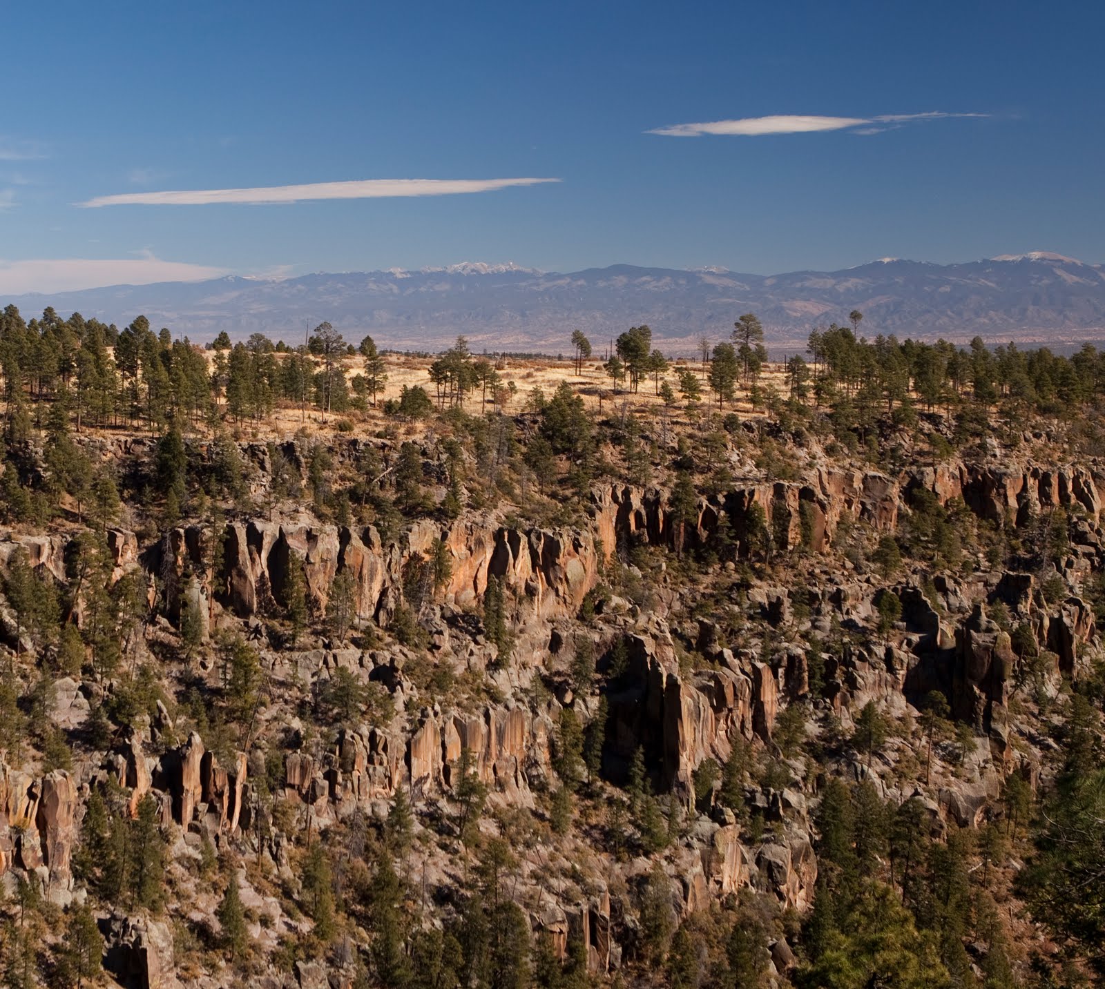
I am pleased that the Valles Caldera is as open as it is now, and I am not suggesting that individuals involved in its management are doing a poor job. Under the circumstances, it is probably the best they can do given the compromises and competing interests. I am not in a position to judge them or their actions. However, I do know a poor use of public land when I see one, and this is an obvious example. The potential for this area is incredible, rivaling that of some of our most beautiful National Parks -- many of which I have visited personally and know quite well.

So, I am pleased that our two Senators are asking for an examination of this issue. I am under no allusions that my complaints about how this is currently managed are going to magically disappear if the NPS is managing it because I suspect that any change in management will occur with the same political compromise baggage. However, I hope that the experience of NPS managing lands combined with public pressure for access will build a better management model over time.

In my opinion, the focus of NPS management should be all about access. Access, access, access. Do away with reservation-only hiking! Or at least greatly minimize it to what it is now. Perhaps it is needed during hunting season or something, I don't know, but make this a convienient place visit. Not a chore. Provide significantly opened up access to the public in much the same way other national parks are managed, including Bandelier which is directly physically connected. I would also like to see work connecting trails from Los Alamos county to this area, all of which are blocked now. There is no real work to do here in many cases other than remove the man made barriers that block these connections at present. I want to be able to drive up and hike. Not just the few trails around the perimeter, but those in the back country as well. There is no reason I should not be able to simply show up and hike. Roads already exist, so mountain biking should also be allowed as it is in some other national parks in the country with similar roads already in place. At a minimum I should be able to show up and hike up those roads to reach the other trailheads rather than be forced to ride in a van and schedule my hike accordingly.

I would also like to see this be a resource with information on the NPS website, just like other national parks, with the same quality, consistency, and information. It would help draw people to the area and help the local economy. If the trails were connected from some of the excellent hiking trails in Los Alamos county, it would be a great way to advertise the area with this as a real connection, not an invented one that requires a 25 minute drive and pre-scheduling activities.

I do worry that NPS staffing limitations and whatever initial processes they would have to go through (e.g. NEPA) before they could take it over would actually restrict access more than it is now, at least initially. So the transition would have to be manged such that this does not happen, and also such that there is a tangible opening up of access right away in this transition to build public trust and give the NPS an initial win. The focused intent here should be on public access under the NPS umbrella of resource protection. I have never liked the current management model and have stayed away as a result, with the exception of the trails near the outer boundaries where I can just show up and hike on my schedule. I know many other people with this same view. I hope this study is a sign that this will all change in a relatively short period of time, and not get caught in the political compromise and special interest cycles. That would only serve to provide the same type of access we have now under a different management umbrella.

I plan to write these two Senators about this issue, and support the management change with the caveat of focusing on more public access. If you are moved to do the same, you can email Senator Bingaman and Senator Udall and Representative Ben Lujan.

Thursday, June 25, 2009

Guaje Canyon Hike Update

I promised to post a GPS trail with topo map once I got the proper maps installed for the Guaje Canyon hike I took last weekend. The maps came today and I installed them. The trail I took is shown on the map below.


The way points and other information are discussed in the post describing the hike from June 13, 2009 (below).